Performing Geospatial Queries and Analysis
Geospatial queries allow you to perform complex location-based queries on data. MongoDB supports geospatial data and provides robust tools for storing, querying, and analyzing this type of data. Whether you’re building location-based apps like real-time delivery tracking, location-based recommendations, or geographic analysis tools, MongoDB’s geospatial features enable efficient handling of spatial data.
Introduction to Geospatial Data in MongoDB
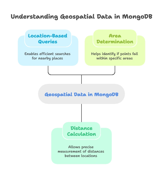
Geospatial data involves information related to specific locations or areas on the Earth’s surface. MongoDB provides built-in support for geospatial data, allowing developers to perform efficient location-based queries such as finding nearby places, calculating distances, and determining whether certain points fall within a specific area.

Why Use Geospatial Queries?
Geospatial queries are essential for various real-world applications, including:
- Maps and Navigation: Finding routes or calculating distances between points.
- Delivery Services: Identifying delivery zones or the nearest available delivery personnel.
- Social Media: Suggesting nearby friends or events.
- Retail and Location-Based Services: Finding nearby stores or points of interest.
Setting Up Geospatial Data in MongoDB
In MongoDB, geospatial data is stored as coordinates in a specific format. There are two main types of geospatial formats MongoDB supports:
- GeoJSON: A standard format that allows you to store data as points, lines, polygons, and multi-shapes.
- Legacy Coordinate Pairs: A simpler structure for two-dimensional points.
To use geospatial data effectively, it must be indexed appropriately using MongoDB’s 2dsphere or 2d index types.
Understanding GeoJSON and Legacy Coordinate Pairs
GeoJSON Format
MongoDB supports the GeoJSON format, which is a widely accepted format for representing geographical data. Here are common GeoJSON objects used in MongoDB:
- Point: Represents a single location.
- LineString: Represents a series of points connected in a line.
- Polygon: Represents an area enclosed by multiple points.
Example: GeoJSON Point Format
					{
    "location": {
        "type": "Point",
        "coordinates": [-73.856077, 40.848447]
    }
}
Legacy Coordinate Pairs
The legacy coordinate format is simpler but only supports 2D points. It does not support advanced GeoJSON objects like LineString or Polygon.
Geospatial Indexes
MongoDB requires a geospatial index to perform geospatial queries efficiently. There are two types of geospatial indexes:
- 2dsphere Index: Used for GeoJSON data to support spherical (Earth-like) queries.
- 2d Index: Used for simple, flat 2D coordinate queries.
Example: Creating a 2dsphere Index
To create a geospatial index on the location field in MongoDB, use the following command:
db.places.createIndex({ location: "2dsphere" });
This index type allows for more complex geospatial queries on GeoJSON data, such as finding nearby points and calculating distances based on spherical geometry.
Geospatial Query Types
MongoDB supports a variety of geospatial queries for different purposes. The primary geospatial query types include:
- $near: Finds documents near a specific point.
- $geoWithin: Finds documents within a specific geometric shape (polygon, box, etc.).
- $geoIntersects: Finds documents that intersect with a given shape.
Examples of Geospatial Queries
Finding Nearby Points with $near
The $near query is used to find documents close to a specific point, sorted by proximity.
Example: Finding the Closest Locations
This example finds the locations within 5,000 meters of a given point.
					db.places.find({
    location: {
        $near: {
            $geometry: { type: "Point", coordinates: [-73.856077, 40.848447] },
            $maxDistance: 5000
        }
    }
});
Explanation
- $geometry: Specifies the center point to search around.
- $maxDistance: Limits the search to a specified distance in meters.
Sample Output
					[
    { "name": "Central Park", "location": { "type": "Point", "coordinates": [-73.97, 40.78] } },
    { "name": "Times Square", "location": { "type": "Point", "coordinates": [-73.985, 40.758] } }
]
This query returns locations sorted by proximity to the specified point.
Finding Locations Within a Polygon Using $geoWithin
The $geoWithin query is used to find points that fall within a specified area, such as a polygon.
Example: Finding Locations Inside a Polygon
					db.places.find({
    location: {
        $geoWithin: {
            $geometry: {
                type: "Polygon",
                coordinates: [[
                    [-73.856077, 40.848447],
                    [-73.961452, 40.848447],
                    [-73.961452, 40.768547],
                    [-73.856077, 40.768547],
                    [-73.856077, 40.848447]
                ]]
            }
        }
    }
});
Explanation
- $geoWithin: Finds documents within a given polygon.
- Polygon: Specifies the area to search within.
Sample Output
					[
    { "name": "Location A", "location": { "type": "Point", "coordinates": [-73.88, 40.82] } },
    { "name": "Location B", "location": { "type": "Point", "coordinates": [-73.92, 40.78] } }
]
Advanced Geospatial Analysis
Calculating Distances Between Points
MongoDB’s $geoNear aggregation stage calculates distances from a specified point to other documents.
					db.places.aggregate([
    {
        $geoNear: {
            near: { type: "Point", coordinates: [-73.856077, 40.848447] },
            distanceField: "distanceFromPoint",
            spherical: true
        }
    }
]);
Explanation
- $geoNear: Aggregation stage for proximity-based calculations.
- distanceField: Stores the calculated distance in the output.
- spherical: Specifies spherical calculations (more accurate for Earth distances).
Sample Output
					[
    { "name": "Location A", "distanceFromPoint": 1500 },
    { "name": "Location B", "distanceFromPoint": 3200 }
]
Best Practices for Geospatial Queries
- Choose the Right Index: Use a 2dsphere index for GeoJSON data and a 2d index for legacy coordinates.
- Limit Results for Performance: Set
$maxDistanceor a limited number of returned documents to optimize query performance. - Use Aggregation Pipeline: Use
$geoNearin the aggregation pipeline for distance calculations, as it is optimized for proximity queries. - Validate Input Data: Ensure that geospatial data (coordinates, shapes) are in the correct format before storing them.
MongoDB’s support for geospatial data makes it an ideal choice for location-based applications. Using geospatial indexes and queries, developers can efficiently store and retrieve geospatial data, perform complex proximity calculations, and analyze spatial relationships. MongoDB’s geospatial capabilities enable applications to handle spatial data accurately, whether for location-based recommendations, mapping services, or geographic analysis. Happy Coding!❤️
